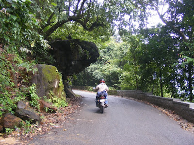
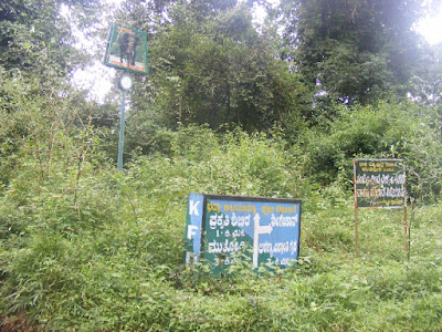
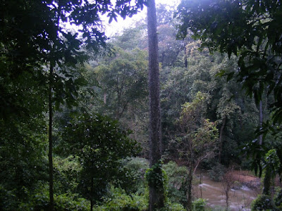
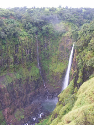
Some of the panaromas from the trip...
Bhadra Wildlife Sanctuary

Kas, Satara

Halebid Temple

Karwar

Muthodi Forest

Satara

Route Map:
View Coastal Karnataka & Malnad on a motorcycle! in a larger map
DAY 1
Route: Pune - Kolhapur - Amboli Ghat - Sawantwadi - Palolem Beach, South Goa. (530 KM)
Amboli ghat waterfall. Not much water due to lack of rains

Riding down the ghat

Something is better than nothing...

Delicious Surmai at Sawantwadi restaurant!

Palolem beach entrance

South side, Palolem beach

The lovely sunsets at Palolem!

Beautiful sunset at Palolem!

Another sunset shot

DAY 2
Route: Palolem - Galgibag Beach- Karwar - Gokarna - Om Beach (100 km approx.)
Galgibag Beach, a turtle nesting site in extreme south of Goa

Galgibag Beach, South Goa

Entering Karnataka from Goa

Karwar beach

Reached Om Beach, Gokarna

Om Beach

Rock formations near Om beach

Sunset at Om Beach

Our cottage at Namaste Cafe, Om beach

Beach view from Namaste cafe, Om beach

The Om beach forms the "Aum"

DAY 3
Route: Om beach - Murdeshwar beach - Marvanthe beach - Agumbe ghat -Sringeri - Chikamaglur (300 km approx.)
Steamed Idli breakfast at Kumta, Coastal Karnataka
 ,
, Nice looking restaurant at Murdeshwar, Coastal Karnataka

Huge Murdeshwar Temple!

Murdeshwar beach

Huge Shiva statue in Murdeshwar

Sea view from Murdeshwar

Murdeshwar beach

Me at Marvanthe beach

The scenic Marvanthe beach

My bike at Marvanthe
 d
dTurtle Bay beach

Overlooking the Agume ghats

Climbing Agumbe Ghats (Supposed to be second wettest place after Cherrapunji)

A truck climibing the winding roads of Agume Ghat

The road from Agumbe to Chickmaglur is one of the most scenic ride in India.

At a lake alongside the road

Tea n Coffee growing region

Coffee plantations on Agumbe - Chickmaglur road

River flowing near the Bhadra sanctuary

Coffee stop in one of the plantations before chickmaglur

Some refreshing fresh coffee!

Thats where it comes from!

Not yet ready!

The coffee outlet

Scenic countryside

DAY 4
Route: Chickmaglur - Halebid - Belur - Muthodi Nature camp, Bhadra Wildlife Sanctuary (130 km approx.)
Halebid heritage site

Covered most of the places on that road sign

Belur Temple

Tasty dosa for breakfast at Town Canteen, Chickmaglur

Scenic landscapes on the way to Muthodi

Entering the Bhadra Wildlife Sanctuary

Welcoming us probably!

The loose gravel road till the Muthodi nature camp

Well...a road sign in Kannada right inside the forest and nobody there to show the way!!!

Dining area in the Muthodi camp inside the Bhadra Sanctuary

A informtion board in the camp describing the stream flowing through the Sanctuary

Flower or Leaves?

The nature camp, Muthodi

Soma Vahini, the stream flowing near the Camp

Thick evergreen forest

The view from our Cottage!

We had some of the biggest spiders for company with some bed bugs too...they remind you that you are in a forest!

DAY 5
Route: Muthodi Camp - Mulyangiri Peak - Kemnagundi - Chickmaglur - Muthodi Camp (180 km approx)
Spotted some deers on the morning safari inside the core area of the park in a 4x4 Mahindra pickup

Bison sighting

Jungle roads!

Breathaking road from Muthodi forest to Mulyangiri

Riding through the forest

Riding through the sanctuary roads which is supposed to have 35 Tigers!!

Ant attack on my bike!

Amazing road from Muthodi to Mulyangiri Peak ( Karnataka's Highest Peak)

All foggy climbing the Mulyangiri Peak

Strong winds near Mulyangiri peak actually push you...never seen such strong winds!

Anup was feeling a bit down when we arrived at the peak

Whats written there at the peak...help needed!

Reached Kemangundi from Mulyangiri after a very rough ride through some really bad roads

Lokesh, our cook at Muthodi with his sons

Fantastic verndah of our cottage, we spent two amazing nights overlooking the deep forest and listening to some scary but breathtaking noises of the Jungle. One can spot deers, elephants right from the verandah itself...Amazing place!

The stream flowing near the camp

DAY 6
Route: Muthodi - Chickmaglur - Tarikere - Bhadravati town - Shimoga - Jog Falls - Om beach (300 km approx)
Superb NH206

One leech came all the way from Muthodi till Shimoga with me, causing this!!

Not able to spot tigers in Bhadra, we decided to take this safari near Shimoga!

And we spotted the Tiger!

Some posing!

Jog Falls, highest falls in India, engulfed in mist due to the rains that lashed Karnataka later in our trip and caused heavy flooding later on

Back to Om beach and it was raining nonstop from past 3-4 days, soon after we left the place...

DAY 7
Route: Om Beach - Ankola - Hubli - Belgaum (280 km aprox.)
We rode all in the rain the whole day getting drenched and had to cancel Dandeli due to such heavy rains and the road to Karwar was blocked due to flooding so we deicded to climb the ghat and reach Belagaon via Hubli.
It rained n rained n rained....

Morning at Namaste Cafe, Om beach,

DAY 8
Route: Belgaon - Kolhapur - Satara - Thoseghar - Chalkewadi - Satara(280 km approx)
Decided to spend last 2 days at Satara with Anup heading back to Pune
On my way to Thoseghar, Chalkewadi from Satara
 a
aFlowering season, Satara

Thoseghar Falls, Satara

Thoseghar Falls, Satara

On way back to Satara with Sajjangad in the background

DAY 9
Route: Satara - Kas Plateau - Satara - Pune (170 km approx.)
Butterfly captured on the way to Kas

Kas Pathar (Plateau) flowering season

Mushroom!

Some flower!

Flowers everywhere!

More flowers!

Have you seen something like that, ever?

Different colours

Lake on Kas plateau filled with Lotus bloomings
